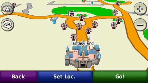
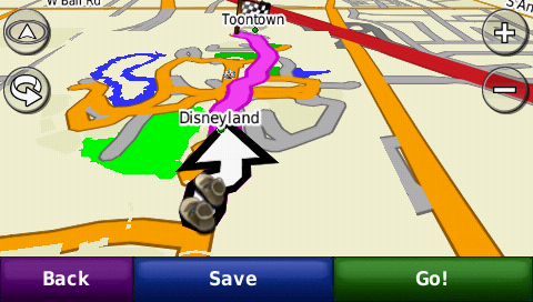
I'm going to Orlando Disneyland, in April/2010, this map also works in Orlando? or it's only Disneyland of California?
Welcome guest, is this your first visit? Click the "Create Account" button now to join.
Results 1 to 7 of 7
-
15th December 2009, 11:26 PM #1
 Garmin disneyland and disney california adventure theme park
GARMIN DISNEYLAND AND DISNEY CALIFORNIA ADVENTURE THEME PARK
V2009 R1


REVISION HISTORY
While every effort are made to ensure accuracy of this - the map may be slightly out by a few metres.
If you're wondering how far and how long it is to walk from main entrance to Toontown then double back to Indiana Jones etc, just set a "route" and find out!
Just remember to set your GPS to "walk" mode so that it auto routes and calculates the time based on a 5km/h speed - you just get fairly accurate ETAs, depending on how fast you walk.
(BTW - It's 800m from main entrance to Mickey's House in case you're wondering!)

Tested on Nuvi and GPSMAP60CSX with Garmin's Street Navigator North America maps and it displays perfectly - both maps visible and working with no tweaking necessary.

You will also find that most attractions and places are "searchable" on your GPS. I have not really named the streets apart from the main ones to enable some sort of street searching.
All the main areas such as Fantasyland, Adventureland, Frontierland, ToonTown, A Bug's Life, Downtown Disney, Tomorrowland, Paradise Pier, Hollywood Backlot etc are searchable under "Cities"
The roads are also compiled with proper routing hierarchy - eg, Arterial, Collector, Residential street level priorities.

This means that it will route you through main thoroughfares rather than narrow alleys if available - just as when you're driving.
Items available as POIs (most items searchable) include
◦All major rides
◦All major attractions and shows
◦Toilets
◦Food and Drinks
◦Shops
Free DISNEYLAND & CALIFORNIA ADVENTURE maps 2009 R1.exe (768 KB)
homepageCode:Please Login or Register to see the links
Code:Please Login or Register to see the links
Last edited by catymag; 16th December 2009 at 02:56 AM.

You have to navigate to get to the good.
Galaxy S5 Kitkat 4.4.2 / Nuvi1200->1250 / Nuvi3790T->34xx / Nuvi 2200 / Nuvi 66 / Oregon 600
-
23rd December 2009, 01:07 PM #2Member


- Join Date
- Dec 2009
- Location
- Brazil
- Posts
- 19
- Rep Power
- 0

-
13th June 2010, 08:02 PM #3Member +


- Join Date
- Mar 2010
- Location
- Brazil
- Posts
- 41
- Rep Power
- 69

There is no similar of Orlando Disney?
-
13th June 2010, 08:53 PM #4
-
17th July 2011, 12:31 AM #5Member


- Join Date
- May 2011
- Location
- Brazil rj
- Age
- 54
- Posts
- 5
- Rep Power
- 0

the link doesnt work, file not found....
-
17th July 2011, 09:22 AM #6Junior Member


- Join Date
- Mar 2008
- Location
- Bahrain
- Posts
- 6
- Rep Power
- 0

Was planning to go for vacation. This may come in handy. Thanx a lot.
-
17th July 2011, 10:31 AM #7

link replaced, but visit author's page if it's deleted again
 the map is free
POIs here
Code:Please Login or Register to see the links

You have to navigate to get to the good.
Galaxy S5 Kitkat 4.4.2 / Nuvi1200->1250 / Nuvi3790T->34xx / Nuvi 2200 / Nuvi 66 / Oregon 600


 Likes:


 Reply With Quote

Bookmarks